Everything you need to know about navigating the highways, expressways, and transportation systems of Central Florida
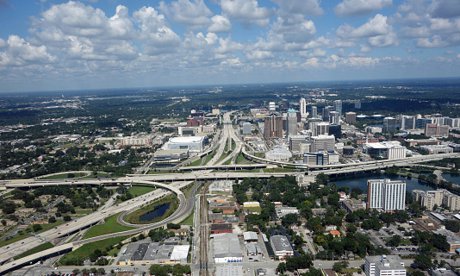
So you're thinking about moving to Central Florida, or you've just arrived and you're trying to figure out the maze of highways, expressways, and toll roads that crisscross the Orlando metro area. Trust me, it can feel a bit overwhelming at first – especially if you're coming from a city where the interstate system is more straightforward or where toll roads aren't the norm.
Here's the thing: once you understand the basic layout of Central Florida's road network, getting around becomes second nature. The region has invested billions in transportation infrastructure over the past few decades, creating a system that (when there's no traffic) can get you almost anywhere relatively quickly. Whether you're commuting to work, heading to the theme parks, or making a weekend beach run, knowing which roads to take makes all the difference.
In this guide, we're breaking down everything you need to know about Central Florida roads and transportation – from the major interstates to the toll expressways, from SunPass to rush hour patterns. Consider this your insider's guide to navigating Orlando like a local. For more comprehensive transportation information, check out our Orlando Transportation Guide.
The Big Picture: Understanding Central Florida's Road Network
Central Florida's transportation system is built around a hub-and-spoke model, with downtown Orlando at the center and major roads radiating outward. The network includes free highways (like I-4), toll expressways, and an extensive system of local roads that connect neighborhoods throughout the metro area.
What makes Central Florida unique is the heavy reliance on toll roads. While this might seem like a drawback at first, these expressways are generally well-maintained, less congested than free alternatives, and offer faster travel times. Plus, with electronic toll collection (no stopping to pay cash!), the process is pretty seamless once you're set up.
The region's road system serves a massive and diverse population – from Downtown Orlando out to suburbs like Clermont in the west, Sanford in the north, and Kissimmee in the south. Understanding how these roads connect is key to choosing where to live based on your work commute and lifestyle needs.
The Major Players: Key Highways and Expressways
Interstate 4 (I-4): The Spine of Central Florida
If there's one road that defines Central Florida, it's Interstate 4. Running east-west through the heart of Orlando (yes, the "east-west" designation is confusing since it runs more northeast-southwest through our area), I-4 is the main artery connecting Tampa to Daytona Beach and passing right through downtown Orlando.
Here's what you need to know about I-4: it's free, it's critical, and it's often congested. This 132-mile interstate sees some of the highest traffic volumes in Florida, especially through the International Drive resort area and downtown corridor. The recent I-4 Ultimate improvement project has added express lanes in the central section, which help – but rush hour is still rush hour.
I-4 serves these key areas:
- Downtown Orlando and the business district
- The theme park corridor (Disney World, Universal Orlando, SeaWorld)
- Major employment centers in Maitland and Altamonte Springs
- Connections to both Orlando International Airport via 528 and Orlando Sanford International Airport via 417
Local tip: Download the FDOT 511 app to check real-time traffic before getting on I-4. Also, if you're commuting daily on I-4, consider the express lanes (tolled but faster during peak times).
The Florida Turnpike: Your Express Route North-South
The Florida Turnpike is the granddaddy of Florida's toll road system, running from Miami all the way to the Georgia border. In Central Florida, it provides a crucial north-south route that bypasses much of the congestion you'd encounter on I-4.
The Turnpike is especially important if you're living in areas like Ocoee, Clermont, or anywhere in west Orange or Lake County. It connects seamlessly with other toll roads, making it part of a broader network that can get you across the metro area efficiently.
SR 408: The East-West Expressway
The 408 Expressway (officially the Spessard Holland East-West Expressway) is a toll road that runs – you guessed it – east to west across Orlando. It's particularly useful for getting from downtown Orlando to the eastern suburbs, including the UCF area, Waterford Lakes, and eventually connecting to State Road 417.
Many downtown workers who live east of the city swear by the 408. It's faster and less stressful than navigating surface streets or dealing with I-4 congestion. The downside? Tolls add up, so factor that into your commuting budget if you'll be using it daily.
SR 417: The Central Florida GreeneWay
The 417 Expressway is a semicircular toll road that acts as an eastern beltway around Orlando. It's a game-changer for people living in or traveling to eastern communities like Lake Nona, Oviedo, and areas near Orlando International Airport.
The 417 connects to I-4 in multiple locations and provides access to the Beachline Expressway for trips to the coast. It's especially popular with airport travelers and anyone looking to avoid the I-4 parking lot during peak hours.
SR 429: The Western Beltway
The 429 Expressway (also called the Daniel Webster Western Beltway) mirrors the 417 on the western side of metro Orlando. This toll road is crucial for accessing western communities like Apopka, Winter Garden, and Mount Dora.
The 429 has been a catalyst for development in west Orange and Lake Counties, opening up previously rural areas for residential and commercial growth. If you work in downtown Orlando but want that small-town feel with newer homes and more land, communities along the 429 corridor are worth exploring.
SR 528: The Beachline Expressway
Want to hit the beach? The Beachline Expressway (SR 528) is your friend. This toll road runs east from I-4 all the way to Port Canaveral and Cocoa Beach, making it the primary route for Central Florida residents heading to the Atlantic coast.
The Beachline also provides access to Orlando International Airport and serves as a key connection for cruise passengers heading to Port Canaveral. Weekend traffic can get heavy, especially during summer, but it's still the fastest way to get from Orlando to the beach.
Beyond the Highways: Alternative Transportation Options
While Central Florida is definitely a car-centric region, there are other transportation options worth knowing about, especially if you're trying to reduce your reliance on driving or want alternatives for specific trips.
SunRail: The Commuter Train
SunRail is Central Florida's commuter rail system, running north-south from DeBary through Orlando to Poinciana. If you work in downtown Orlando and live near a SunRail station in areas like Lake Mary, Winter Park, or Kissimmee, this can be a stress-free commuting option.
The system has its limitations – it doesn't run on weekends and has limited evening hours – but for weekday commuters, it's a solid alternative to sitting in I-4 traffic. Plus, stations are located in walkable downtown areas with restaurants and shops.
Lynx: Public Bus System
Lynx is the regional bus system serving Orange, Seminole, and Osceola counties. While bus service isn't as comprehensive as in major northeastern cities, Lynx does provide valuable connections throughout the metro area, particularly for those without access to a car or looking to save on transportation costs.
Brightline: High-Speed Rail
The newest addition to Central Florida's transportation landscape is Brightline, a high-speed rail service connecting Orlando to South Florida (Miami, Fort Lauderdale, West Palm Beach). The Orlando station is at the airport, making it convenient for travelers and commuters.
While Brightline isn't a daily commuting option for most people, it's a fantastic alternative to driving or flying when you need to get to South Florida for business or pleasure. The trains are modern, comfortable, and way less stressful than fighting I-95 traffic.
Practical Information: Tolls, Traffic, and Tips
How to Handle Tolls
Central Florida uses all-electronic tolling, meaning no toll booths or cash collection. You have two options:
1. Get a Transponder – Either a SunPass (through the state) or E-PASS (through the CFX) gives you the best rates and most convenience. These small devices stick to your windshield and automatically pay tolls as you drive. Both systems work on all Florida toll roads.
2. Toll-By-Plate – If you don't have a transponder, cameras photograph your license plate and a bill is mailed to the registered owner. This costs significantly more (sometimes 50% more than transponder rates) and comes with additional fees.
Our take: Get a transponder. The cost savings alone make it worthwhile if you use toll roads even occasionally, and you'll avoid the hassle of bills showing up in the mail. You can get one at most grocery stores or order online.
When Is Rush Hour?
Central Florida's rush hour patterns are similar to most metro areas but with some tourism-related quirks:
- Morning rush: 7:00 AM – 9:00 AM (earlier is better)
- Evening rush: 4:30 PM – 6:30 PM (later is better)
- Weekend anomalies: Saturday mornings and Sunday evenings can see heavy traffic due to theme park visitors and weekend travelers
- Holiday impacts: Spring break, summer vacation, and major holidays bring significantly heavier traffic, especially near the theme parks and on routes to the beaches
Smart Commuting Strategies
If you're planning your commute or choosing where to live based on work location, consider these factors:
- Reverse commute advantage: Living east and working west (or vice versa) often means lighter traffic since you're going opposite the main flow
- Expressway access: Living near an expressway entrance (408, 417, 429) can shave significant time off your commute, but factor toll costs into your housing budget
- SunRail proximity: If your work is near a downtown station, living near a SunRail station in suburbs can be a game-changer for stress-free commuting
- Remote work flexibility: Even one or two remote days per week dramatically improves your quality of life in Central Florida's car-oriented culture
The Bottom Line
Navigating Central Florida's roads and transportation system might seem daunting at first, but it quickly becomes second nature. The region has invested heavily in infrastructure, and while traffic can be frustrating (especially on I-4), the network of toll expressways provides efficient alternatives for getting around.
The key to making it work is understanding the system before you arrive. Get your SunPass or E-PASS set up early, download a traffic app, and research commute times from potential neighborhoods to your workplace during actual rush hour (not at 2 PM on a Tuesday). Most importantly, factor both commute time and toll costs into your decision about where to live – a house that's $100 cheaper per month doesn't save you money if you're spending $150 in extra tolls and gas.
Central Florida's transportation landscape continues to evolve, with ongoing improvements to I-4, expansions of the toll road network, and discussions about extending SunRail service. The region recognizes that efficient transportation is crucial to continued growth and quality of life. While we may never be a walkable, transit-oriented city like New York or San Francisco, the transportation options here work well once you understand them.
For detailed information about Florida's roads, tolls, and travel conditions, visit the Florida Department of Transportation website and download their 511 app for real-time traffic updates.
Ready to explore Central Florida neighborhoods? Check out our Best Places to Live in Orlando guide or browse Orlando neighborhoods to find your perfect community based on commute and lifestyle preferences!