The Neighborhood Blog

The Neighborhood Blog features a variety of community, attraction and development update information for communities throughout the Orlando Metro and Central Florida Region.

June 1, 2026

Central Florida Festivals & Traditions: A Local's Guide

Central Florida Festivals & Traditions: A Local's Guide

From world-class art shows to Disney's seasonal blowouts, here are the events that quietly run the Central Florida calendar
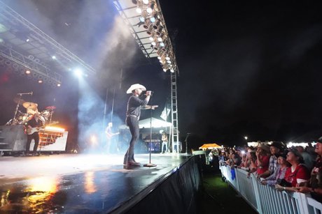
Festivals, events and traditions in the Central Florida area.

Central Florida hosts a year-round slate of festivals and traditions anchored by the Winter Park Sidewalk Art Festival (March), the Mount Dora Arts Festival (early February), and the ZORA! Festival in Eatonville (late January). The Winter Park Sidewalk Art Festival, launched in 1960, is one of the nation's oldest and largest juried outdoor fine art shows and draws roughly 250,000 visitors each year. EPCOT at Walt Disney World runs four seasonal festivals annually, with the fall Food & Wine Festival the largest. Most major Central Florida festivals follow a predictable calendar, so residents can plan around the same events every year.

So you've heard Orlando is "the theme park city" — but here's something most people scoping out a move don't realize: the region's real social calendar isn't set by Disney. It's set by a string of Central Florida festivals and traditions that come back the same weekend, year after year, in towns you've probably never heard of yet.

Let's be real: once you live here, the parks become the thing your out-of-town guests want to do. What actually marks the passing of the year for locals is the art festival that takes over a downtown every March, the craft fair that fills a lakeside town in February, and the cultural celebration that's been running for decades. Knowing this calendar is part of knowing the region — so let's walk through it like neighbors comparing notes.

A Little History: How a "New" Region Built Old Traditions

Here's the thing about Central Florida — it gets dismissed as a place with no history because so much of it was built after 1971. That's only half true. The festival calendar tells the older story. The Winter Park Sidewalk Art Festival debuted in 1960, more than a decade before Walt Disney World opened. The Mount Dora Arts Festival started in 1975. And the ZORA! Festival celebrates a town — Eatonville — that was incorporated in 1887 as one of the first self-governing Black municipalities in the United States.

In other words, the traditions came first. The theme parks are the newcomers.

The Marquee Festivals Worth Building a Weekend Around

Winter Park Sidewalk Art Festival (March)

If you attend one festival a year, make it this one. Held every March in Central Park and along the brick-lined Park Avenue in Winter Park, it's one of the nation's oldest, largest, and most prestigious juried outdoor fine art festivals. We're talking roughly 225 artists selected from more than 1,000 applicants, and around 250,000 visitors over three days. Admission is free, the oaks are gorgeous, and the people-watching rivals the art. (There's also a smaller Autumn Art Festival in November if you miss the spring one.)

Mount Dora Arts Festival (Early February)

About 35 miles northwest of downtown sits Mount Dora, a hilly lakeside town that feels more New England than Florida. Its arts festival has run since 1975 and now draws around 300 juried fine artists to the historic downtown streets the first weekend of February. It's free, it benefits the Mount Dora Center for the Arts, and it pairs perfectly with the town's antique shops and cafés. Pro tip: park at the free shuttle lot rather than circling downtown for an hour.

The ZORA! Festival in Eatonville (Late January)

This one matters. Eatonville — just northeast of Winter Park, about 30 minutes from the tourist corridor — was the hometown of author and folklorist Zora Neale Hurston. First presented in 1990, the ZORA! Festival is a multi-week celebration of African American culture, scholarship, and art, anchored by a three-day Outdoor Festival of the Arts along Kennedy Boulevard. It's a genuine piece of American cultural history happening in your new backyard, and it's well worth the trip. If you're an arts person, the nearby Maitland Art & History Museum makes a great companion stop.

Disney's Year-Round Festival Machine

You can't talk Central Florida traditions without EPCOT. The park runs four seasonal festivals on a rolling annual calendar: the Festival of the Arts in winter, the Flower & Garden Festival in spring, the famously popular EPCOT Food & Wine Festival in fall, and the Festival of the Holidays through late November and December. Here's the local-friendly part: each one is included with regular admission, so if you hold an annual pass (and a lot of residents do), the festivals essentially become a free, ever-changing reason to drop in for an afternoon.

Downtown Orlando's Homegrown Traditions

Closer to the urban core, Downtown Orlando centers much of its festival life on Lake Eola Park, the swan-boat lake that functions as the city's living room. The springtime Fiesta in the Park — an arts-and-crafts tradition that has run for more than 35 years — fills the streets around the lake with vendors, food, and live music. The lake also anchors farmers markets, holiday tree lightings, and one of the largest Pride celebrations in the Southeast each fall.

The Real Deal: Pros and Cons of Living in a Festival-Heavy Region

Let's be honest about what a packed calendar actually means day to day.

The Pros:

  • There's almost always something free and worthwhile happening within a 40-minute drive.
  • Festivals make it easy to meet neighbors and plug into a community fast — a real perk if you're relocating without a built-in social circle.
  • Many events are walkable, family-friendly, and rooted in genuine local history, not manufactured for tourists.

The Cons:

  • Parking and traffic in host towns (Winter Park and Mount Dora especially) get rough on festival weekends — plan to arrive early or use shuttles.
  • Peak festival season clusters in the cooler, drier months. Summer is quieter outdoors for good reason: heat and afternoon storms.
  • Living near a popular festival venue means occasional road closures and crowds a few weekends a year.

Festivals in Your Own Backyard

The marquee events get the headlines, but every community we cover has its own local rhythm — seasonal markets, holiday celebrations, food truck nights, and town-center events. If you're weighing neighborhoods, the local calendar is worth a look. Browse our comprehensive Winter Garden events guide, Celebration events guide, and Kissimmee events guide to see what each town has going on. For the broader arts scene, our Orlando arts and culture guide and Orlando events guide round out the picture.

What the Neighbors Know

The locals' secret is simple: the festival calendar is one of the best (and cheapest) ways to figure out which Central Florida town actually fits you. Spend a March Saturday in Winter Garden at a farmers market, a February weekend in Mount Dora at the arts festival, and a fall afternoon at Lake Eola, and you'll learn more about where you'd want to live than any spreadsheet of home prices can tell you.

The traditions here are real, they're recurring, and they're the part of Central Florida life that visitors never see — but residents build their year around. That's the stuff that turns a new address into a home. 🎨

For dates, details, and this year's lineups, check the official sites for the Winter Park Sidewalk Art Festival, the Mount Dora Arts Festival, and the ZORA! Festival.


Trying to figure out which Central Florida community matches your lifestyle? Start with our Geography of Orlando guide, or contact us for personalized relocation advice. We'll help you find the neighborhood — and the festival calendar — that feels like home.
June 1, 2026

The Geography of Orlando: Where to Live

The Geography of Orlando: Where to Live

A relocating family's honest map of Central Florida — which direction fits your life, and what each one costs you

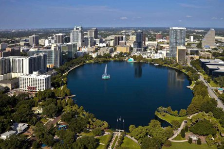
Lake Eola and Downtown Orlando

The Orlando-Kissimmee-Sanford metropolitan area covers four counties — Orange, Seminole, Osceola, and Lake — and reached roughly 2.96 million residents in mid-2025, adding about 725 new residents per week. Interstate 4 runs diagonally southwest-to-northeast through the center of the metro and serves as its main spine. West and southwest Orange County hold the newest family communities, the urban core and close-in north offer walkability and mature neighborhoods, and the outer counties trade longer commutes for lower home prices. Where you should live in Orlando depends mostly on commute, school zone, and budget rather than on proximity to the theme parks.

Here's the thing most people don't realize until they're house-hunting here: "Orlando" isn't really a city you move to — it's a sprawling, four-county region you pick a corner of. The metro covers more than 4,000 square miles, and east side versus west side can mean an hour of your day, two different school districts, and a six-figure swing in what your money buys.

So before you fall in love with a listing photo, let's get our bearings — by direction and by trade-off. Because almost nobody who lives here picks a house based on how close it is to Disney.

First, Forget the Theme Parks for a Second

The official Orlando-Kissimmee-Sanford metro area is made up of four counties: Orange (the heart, wrapped around Downtown Orlando), Seminole County to the north, Osceola County to the south, and Lake County to the west. According to the Orlando Economic Partnership, the region hit roughly 2.96 million residents in 2025 and is the fastest-growing metro in Florida.

The single most useful thing to understand is Interstate 4. It cuts diagonally through the metro from southwest to northeast, and nearly everything that matters — downtown, the attractions, the hospital systems, the biggest job centers — sits along or near it. I-4 is also the road locals love to hate, so much so that we wrote a whole piece on Interstate 4. Where you live is, in large part, a decision about which side of I-4 you want to be stuck on.

West & Southwest: The Family Heartland

If you're relocating with kids and a "we want newer and good schools" wish list, odds are you'll end up looking here first. This is where the bulk of our community coverage lives, and it's no accident — it's where the growth is. We're talking Dr. Phillips, Windermere, Horizon West, Winter Garden, Ocoee, and tiny, leafy Gotha, plus the office-and-condo cluster of MetroWest.

The appeal is real: master-planned neighborhoods, A-rated schools, and brand-new construction. Horizon West in particular is one of the most-watched master-planned areas in the country. For the school details that drive so many of these moves, our Winter Garden schools and education guide and Dr. Phillips schools and education guide break it down by zone.

The honest trade-offs: this corner leans heavily on toll roads (the 429, 408, and Turnpike), and tolls add up for daily commuters. Many newer communities carry both HOA and CDD fees. And you're about as far from the Atlantic beaches as the metro gets — figure 75 to 90 minutes.

Downtown & the Close-In North: Character Over New

Want sidewalks, tree canopy, and a front porch instead of a privacy wall? Look at the urban core and the older neighborhoods just north of it. Downtown Orlando wraps around Lake Eola, and just beyond it sit established favorites like Baldwin Park, the boutique-and-brick charm of Winter Park, and quieter Maitland. College Park and the Milk District round out the close-in options.

This is the walkable, lived-in Orlando — museums, brick streets, the kind of place you can actually stroll to dinner. If that's your speed, our guide to lakeside Orlando and the Winter Park character guide are worth a read.

The honest trade-offs: you pay for it. Price per square foot runs higher than the suburbs, lots are smaller, and homes are older (1920s–1960s) — more maintenance and fewer modern floor plans. You're trading a new kitchen for a mature oak tree.

The East Side: Jobs, Value & the UCF Effect

East Orange County orbits the University of Central Florida — one of the largest universities in the nation — plus the Research Park tech corridor. Neighborhoods like Avalon Park and Waterford Lakes deliver solid value and a self-contained, suburban feel, anchored by spots like the Waterford Lakes Town Center.

If you (or a spouse) work in defense, simulation, or tech, the east side puts you minutes from work instead of an hour. The catch: you're on the opposite end of the metro from the attractions side, so it's a great fit for people whose daily life points east and a frustrating one for those constantly crossing the whole metro.

The Southeast: Lake Nona & the Planned Future

Southeast of downtown, Lake Nona has become the metro's poster child for master planning — home to "Medical City," a cluster of hospitals and research institutions, and minutes from Orlando International Airport (MCO). It's smart, modern, and built around walkable town centers.

Just south, in Osceola County, you'll find Kissimmee, the Disney-built town of Celebration, and family-favorite Hunter's Creek along the Orange/Osceola line. The honest trade-off for Lake Nona specifically: it's still filling in, so resale "character" is limited and CDD fees are common — you're buying into a vision as much as a neighborhood.

The Suburban North & Outer Counties

North into Seminole County, established suburbs like Altamonte Springs, Lake Mary, and historic Sanford (plus Oviedo) are known for strong, mature school systems and a more settled feel. The SunRail commuter train also runs up this corridor, which is a genuine perk — see our SunRail guide.

Push farther out and you trade minutes for dollars. Apopka to the northwest, Clermont's rolling hills in Lake County, and antique-town Mount Dora all stretch your budget further. If sorting counties feels overwhelming, our comparison of Orlando's four counties lays the differences side by side.

So How Do You Actually Choose?

Let's be real — you can't optimize for everything. After helping a lot of families land in the right spot, we've found it comes down to four questions, roughly in this order:

  • Where's the commute? Pin your workplaces first, then shop neighborhoods around them. Crossing the whole metro daily is the #1 regret we hear.
  • Which school zone? Florida lets you look this up before you buy. Don't assume a "good area" equals a good assigned school — verify the specific zone.
  • New or character? West/southwest for new and master-planned; the close-in north for walkable and mature. Be honest about which you'll actually enjoy living in.
  • What's the true monthly cost? Tolls, CDD fees, HOA dues, and insurance vary a lot by area. See our honest cost-of-living breakdown and our look at Central Florida's school districts compared.

What the Neighbors Know

The locals' secret is almost boring: nobody who lives here organizes their life around the parks. We organize it around our commute, our kids' schools, and how much house we want for the money. The theme parks are a once-or-twice-a-year thing, not a daily one.

So pick your corner deliberately. The west and southwest give you new and family-friendly at the cost of tolls and beach distance. The urban core gives you walkable character at a premium. The east gives you value and jobs if your life points that way. And the outer counties give you the most house for the least money — if you can stomach the drive. There's no wrong answer, only the one that matches your actual day-to-day. 🧭

For regional data, economic trends, and the official picture of how Central Florida is growing, visit the Orlando Economic Partnership.


Trying to figure out which corner of Central Florida fits your family? Browse our Orange County communities or contact us for personalized, no-pressure relocation advice. We'll help you weigh the trade-offs honestly.

Posted in Relocation Guide
June 1, 2026

Highway 192: Central Florida's Irlo Bronson Memorial Highway

Highway 192: Central Florida's Irlo Bronson Memorial Highway

The 75-mile road that connects Disney to the coast — and why it matters if you're moving to Osceola County

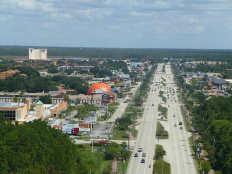
Hwy 192 in Kissimmee

Highway 192, officially the Irlo Bronson Memorial Highway, is a 75-mile east-west route across Central Florida running from US 27 in Four Corners, Lake County, past Walt Disney World and through Kissimmee and St. Cloud to the Atlantic coast at Indialantic. It is also known as Space Coast Parkway and carries State Road 530 through the Kissimmee area, where it is named Vine Street; in St. Cloud it becomes 13th Street. The tourist corridor west of Kissimmee spans roughly 15 to 20 miles and supports an estimated 1,800 businesses and about 30,000 jobs. US 192 was extended west in 1972 to serve the newly opened Walt Disney World and was named for Kissimmee cattleman and state legislator Irlo Bronson after his death in 1973.

If there's one road that explains how Central Florida actually fits together, it's Highway 192. Locals just call it "192," but its formal name is the Irlo Bronson Memorial Highway — and depending on where you are along its 75-mile run, it might also be called Space Coast Parkway, Vine Street, or 13th Street.

For anyone considering a move to Kissimmee, St. Cloud, or anywhere in southern Osceola County, this is the road you'll learn to navigate by heart. It's part tourist spectacle, part everyday artery, and part time capsule of how the region grew up around Walt Disney World. Here's the honest local rundown.

What Highway 192 Actually Is

Highway 192 is a U.S. route that runs east to west (or west to east, depending on which way you're driving) across the middle of the state. It stretches roughly 75 miles, beginning at a junction with US 27 in Four Corners up in Lake County and ending one block from the Atlantic Ocean at State Road A1A in Indialantic, over on the Space Coast.

Most of that distance carries the Irlo Bronson Memorial Highway name. Through the Kissimmee area it doubles as State Road 530, and the street signs switch to "Vine Street" as you head into the urban core. Cross into St. Cloud and it becomes "13th Street." It even briefly runs concurrent with its parent route, US 92, near downtown Kissimmee. So yes — one road, many names.

From Cattle Country to Disney's Doorstep

Here's the part most newcomers don't know. Before the theme parks, this stretch of Central Florida was cattle country — wide-open ranch land. The man the highway is named for, Irlo Overstreet Bronson, Sr., was a Kissimmee cattleman who served in both the Florida House of Representatives and the Florida State Senate.

Bronson famously sold a sizable chunk of his Osceola County land to the Disney Company for about $100 per acre. His family reportedly felt he'd let it go for far less than it was worth, but Bronson believed Disney's arrival would create better opportunities for local kids and a reason for them to stay. After he died in 1973, the corridor was designated the Irlo Bronson Memorial Highway in his honor.

The road itself was extended westward in 1972, specifically to serve the brand-new Walt Disney World. That extension is what turned a sleepy state road into the tourism engine it is today. (For the resident's angle on the parks themselves, see our guide to Walt Disney World.)

The Three Faces of 192

One reason 192 confuses people is that it behaves like three different roads. Knowing which "face" you're dealing with tells you a lot about the neighborhoods around it.

The Westside Tourist Strip

West of Kissimmee, between Four Corners and roughly SR 535 (Vineland Road), 192 is the classic tourist gauntlet: a dizzying parade of hotels, timeshares, souvenir shops, dinner-show marquees, and family restaurants. This commercial corridor runs about 15 to 20 miles and supports an estimated 1,800 businesses and around 30,000 jobs.

This stretch is also where you'll find the famous mile-marker system — numbered markers that help drivers (and pizza-delivery drivers, and rideshare apps) pinpoint a business along the strip. Fair warning: the markers aren't placed at exact one-mile intervals, so treat them as a rough guide, not GPS.

Vine Street Through Kissimmee

Closer to the city, 192 becomes Vine Street and shifts from resort strip to everyday urban thoroughfare — grocery stores, auto shops, fast food, and the connective tissue of daily life in Kissimmee. This is the part residents actually use to run errands. If you want the pedestrian-friendly historic side of town instead, it's just south of here; explore it in our downtown Kissimmee guide.

13th Street Into St. Cloud

Roughly five miles east of Kissimmee, the highway crosses Florida's Turnpike and slips into St. Cloud as 13th Street. The pace drops noticeably here. St. Cloud keeps a small-town, lakefront-Florida feel that the tourist strip lost decades ago — one of the corridor's better-kept secrets, which you can read about in our downtown St. Cloud guide.

How 192 Connects to the Rest of Central Florida

Part of what makes living near 192 practical is how many other major routes plug into it. From the corridor you can reach just about anywhere in the metro:

  • Interstate 4 — 192 meets I-4 near Celebration, your fastest link to downtown Orlando, Tampa, and the attractions corridor.
  • SR 429 (Western Beltway) — a diamond interchange ties 192 into the 429 Expressway, the toll route north toward Horizon West, Winter Garden, and Ocoee.
  • SR 417 (Central Florida GreeneWay)the 417 Expressway crosses 192 near Celebration and runs straight to Orlando International Airport.
  • Osceola Parkway — the tolled Osceola Parkway offers a quicker alternate between Disney and downtown Kissimmee when 192 is jammed.
  • US 17-92 & US 441US 17-92 and the Orange Blossom Trail (US 441) overlap with 192 through Kissimmee, carrying north-south traffic toward Orlando and Poinciana.

Living Near Highway 192: The Real Deal

Let's be real: 192 has a reputation. Stretches of the tourist strip look tired, and revitalization has been a slow, uneven project for years. But fresh investment is showing up — new chain restaurants, renovated hotels, and modern retail are gradually replacing the faded 1980s roadside vibe. Here's the honest balance sheet for anyone weighing a home nearby.

The Pros

  • Hard-to-beat proximity to Walt Disney World and the attractions corridor
  • Generally more affordable housing than communities farther from the strip
  • Resort-style and vacation-eligible communities ideal for short-term rental investors
  • Excellent connectivity to I-4, SR 429, SR 417, and the Turnpike
  • Everything you need — groceries, dining, services — is minutes away

The Cons

  • Tourist traffic and congestion, especially near the Disney end and on weekends
  • Some commercial stretches still feel dated and are mid-revitalization
  • Noise and bustle in the busiest sections close to the strip
  • Short-term rental neighbors can mean less of a settled, year-round community feel

Our Take

If you want central access, value pricing, and you're comfortable with a lively, touristy backdrop, the 192 corridor delivers. If you crave quiet and a settled neighborhood, look a few blocks off the highway, or lean toward the St. Cloud end where things calm down. For a deeper food-and-fun rundown of the strip, browse our Kissimmee restaurants and dining guide and our Kissimmee shopping guide.

What the Neighbors Know

Highway 192 isn't glamorous, and locals will tell you that with a grin. But it's the spine of southern Osceola County — the road that ties Disney to downtown Kissimmee to small-town St. Cloud, and feeds into nearly every major route in the metro. Understanding 192 is understanding how this corner of Central Florida grew, and how you'll actually get around once you live here.

The neighbor's tip? Learn the mile markers for the strip, learn the toll-road shortcuts for everything else, and remember that the quieter, more livable pockets are usually just off the highway, not on it. Master that, and 192 stops being intimidating and starts being convenient. 🛣️

For official roadway information and ongoing improvement projects, visit the Florida Department of Transportation, which maintains US 192. For visitor and corridor details, check out Experience Kissimmee.


Thinking about a move to the Osceola County area? Explore homes in Kissimmee, St. Cloud, and Celebration, or contact us for personalized relocation advice from people who actually drive 192 every day!

June 1, 2026

US Highway 27: Central Florida's Western Commuter Corridor

US Highway 27: Central Florida's Western Commuter Corridor

The road that quietly connects Clermont, Four Corners, and Davenport to Disney, I-4, and the rest of metro Orlando

US Hwy 27 through Central Florida

US Highway 27 is a north-south US route that runs roughly 496 miles across Florida, from Miami to the Georgia line. In the Orlando area it forms the western edge of the metro, passing through Haines City, Davenport, Four Corners, Clermont, and Minneola. US 27 crosses Interstate 4 at Exit 55 near Davenport and meets US 192 at Four Corners, about 15 to 20 minutes west of Walt Disney World. Through Clermont and Four Corners it is a signalized surface arterial rather than a limited-access expressway. A new 4.4-mile toll road, SR 516 (the Lake/Orange Expressway), is under construction to link US 27 near Lake Louisa State Park to SR 429 at Horizon West, with full completion estimated for 2029.

Ask most Orlando newcomers to name the roads that matter and you'll hear I-4, the 408, maybe the 429. US 27 rarely makes the list. Here's the thing: if you're house-hunting on the affordable, fast-growing western side of the metro, this is the road your daily life will revolve around.

Let's be real: US 27 isn't an Orlando road in the downtown sense — it runs west of the city, through Lake and Polk counties, well clear of the urban core. But that's exactly where a lot of relocating families are landing, because homes cost less and the theme parks are still close. Understanding US 27 is really about understanding that trade-off.

What Exactly Is US Highway 27?

US 27 is one of Florida's great long-haul highways — about 496 miles end to end, from Miami all the way up to the Georgia state line. In our corner of the world, it functions as the metro's western spine, running roughly north-south parallel to (and just west of) the theme-park belt.

Heading from south to north through the Orlando area, US 27 rolls through Haines City and Davenport in Polk County, crosses Interstate 4 at Exit 55, hits Four Corners, and then climbs into Clermont and Minneola in Lake County before continuing toward Leesburg. Important reality check: through the populated stretches it's a signalized surface arterial — four to six lanes with traffic lights and at-grade intersections — not a limited-access expressway. Your travel time depends on red lights, not a steady 70 mph.

From Citrus Groves to Commuter Corridor: A Quick History

Not that long ago, this whole corridor was citrus country. The 226-foot Florida Citrus Tower, built in 1956 just off US 27 in Clermont, was designed so tourists could climb up and gaze out over an ocean of orange groves. Climb it today and you'll see rooftops and retail instead — a pretty literal monument to how fast this area changed.

Fun fact: nearby Sugarloaf Mountain, west of Clermont, is one of the highest points on the Florida peninsula. (Yes, Florida has hills — ask the cyclists who grind up them every weekend.) As the groves gave way to subdivisions, US 27 turned from a rural through-route into the stoplight-dotted arterial it is now.

The Four Corners Connection

The single most important spot on US 27 for Orlando-area movers is Four Corners — literally the point where Lake, Orange, Osceola, and Polk counties all meet. It's where US 27 ties into the two roads that put the theme parks within reach.

First, US 27 crosses Interstate 4 at Exit 55 — your direct line to downtown Orlando one way and Tampa the other. A half-mile north, it meets US 192; head east on 192 and you're at the Walt Disney World area in roughly 15 to 20 minutes, traffic permitting. That combination is why the Davenport and Four Corners stretch became a magnet for vacation homes and short-term rentals. Ever stayed in an Orlando "Disney-area" rental that was technically a 25-minute drive away? Good chance it was off US 27.

Why Orlando-Area Movers Should Care

Here's where it gets practical. The communities strung along US 27 — Clermont, Minneola, Davenport, and the broader Four Corners area — tend to offer more house for the money than you'll find inside the core Orange County communities. For a lot of families, that's the whole appeal: a newer, larger home at a friendlier price, with Disney still a short drive away.

The trade-off is the commute. Heading into downtown Orlando from Clermont generally means SR 50 (Colonial Drive) east — figure roughly 30 to 40 minutes without heavy traffic, and meaningfully more during rush hour. US 27 itself connects east into Orange County through that SR 50 cloverleaf in Clermont, which is the same corridor that eventually leads to Oakland and Winter Garden. Drivers who'd rather skip the stoplights often hop on Florida's Turnpike, which runs roughly parallel to US 27 and has an interchange up at Minneola.

For Disney-side employees who want park access without park-adjacent prices, the math often works. For anyone commuting daily into downtown or the Lake Nona side, the distance adds up fast. Know your daily destinations before you fall for the listing photos.

The Game Changer: SR 516, the Lake/Orange Expressway

This is the development worth watching. The Central Florida Expressway Authority is building SR 516, the Lake/Orange Expressway — a 4.4-mile toll road that will connect US 27 near Lake Louisa State Park to SR 429 at Horizon West. In plain English: it'll give the US 27 corridor a fast, direct link into the 429 beltway and the booming Horizon West side of Orange County.

Be clear on the timeline, though. Construction began in 2024. The SR 429 end is expected to open around spring 2027, but the full connection to US 27 isn't estimated until about 2029. So if a listing implies a quick expressway shot from US 27 into Horizon West "soon," take it with a grain of salt — the road is real and funded, but not open yet.

Driving US 27: The Honest Pros and Cons

The Pros:

  • Direct access to I-4 (Exit 55) and US 192, putting Disney and the parks within a short drive
  • More affordable housing than core Orange County communities
  • Scenic, hilly Lake County stretches near Clermont — not your flat-Florida stereotype
  • The future SR 516 connection promises a faster link to SR 429 and Horizon West
  • Florida's Turnpike runs parallel for a quicker, signal-free alternative

The Cons:

  • It's a stoplight-heavy arterial, not an expressway — expect congestion through Clermont and Four Corners
  • Long commutes to downtown Orlando, Lake Nona, and the east side
  • Heavy tourist and short-term-rental traffic around Four Corners
  • Lots of strip-mall sprawl; the corridor isn't winning any beauty contests

What the Neighbors Know

US 27 is the kind of road locals just understand rather than rave about — the corridor to more affordable homes on the metro's western flank, the road that quietly feeds the Disney-area rental market, and the artery about to get more useful once SR 516 ties it into the 429 beltway.

If you're weighing a move to Clermont, Davenport, or the Four Corners area, the smart play is simple: drive your actual commute at the actual time you'd drive it, on a weekday, before you sign anything. The homes out here can be a fantastic value — you just want to go in clear-eyed about the stoplights. For families researching the western communities, our guides to Celebration (near the Four Corners and US 192 corridor) and the Downtown Clermont scene are good next stops, along with the Lake County Schools Guide and a look at where Horizon West fits in our where is Horizon West location guide.

US 27 is maintained by the Florida Department of Transportation. For current construction updates, lane closures, and project details along the corridor, check the official Florida Department of Transportation site, and for the SR 516 connector specifically, see the Central Florida Expressway Authority project page.


Thinking about a move to Central Florida's western corridor? Explore our Horizon West and Winter Garden community guides, or contact us for honest, local relocation advice — we'll tell you the truth about the commute before you fall in love with the house. 🚗

June 1, 2026

Osceola Parkway: The Toll Road That Quietly Connects Disney to the Turnpike

Osceola Parkway: The Toll Road That Quietly Connects Disney to the Turnpike

CR 522 is one of Central Florida's most-used east-west routes—and its proposed extension is one of the region's most-debated road projects

Osceola Parkway at Walt Disney World

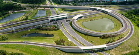
Osceola Parkway (County Road 522) is a 17.5-mile, partially tolled east-west road across northern Osceola County, Florida, connecting the Walt Disney World area to Florida's Turnpike and ending near Buenaventura Lakes. Only the controlled-access section between State Road 417 and a toll plaza east of Shingle Creek is tolled; the rest is a surface arterial with at-grade intersections. The road opened as Dart Boulevard in 1987, became a toll parkway in 1995, and is maintained by Osceola County. The tolled section is all-electronic, so drivers pay by SunPass, E-PASS, or Pay-by-Plate rather than cash. A proposed 9-mile Osceola Parkway Extension would run east from SR 417 near Orlando International Airport toward the Sunbridge area, crossing part of the protected Split Oak Forest.

Ask most Central Florida drivers to name the toll roads they live on and you'll hear the same short list: the 408, the 417, the 429, the Turnpike. But there's a quieter workhorse stitching the southwest metro together that rarely makes that list—Osceola Parkway. If you've ever cut across from the Disney area to the Turnpike without crawling down Highway 192, you've used it.

Here's the thing: this road matters far beyond the neighborhoods it runs through. It's a piece of the regional grid that theme-park workers, airport travelers, and commuters from half a dozen communities rely on every day. And its proposed eastern extension has become one of the most contested road-building fights in the region. Whether you're relocating to Kissimmee, Celebration, or anywhere in southeast Orlando, it's worth understanding.

What Exactly Is Osceola Parkway?

Osceola Parkway, signed as County Road 522, is a 17.5-mile east-west road that runs across the northern edge of Osceola County, roughly hugging the Orange County line. Its western end sits in the Walt Disney World resort area near Disney's Animal Kingdom; from there it heads east past Interstate 4 and SR 417 near Celebration, crosses Kissimmee, and finally peters out at Simpson Road (the old Boggy Creek Road) near Buenaventura Lakes.

The road has two distinct personalities. The western stretch—from Disney through the SR 417 interchange—is a true limited-access expressway with overpasses and a single toll plaza. East of there, it transforms into a regular surface arterial with stoplights, shopping plazas, and at-grade intersections. Same road, completely different driving experience.

Fun trivia: it didn't start as a parkway at all. It opened in 1987 as Dart Boulevard and became a toll road in 1995, as Osceola County raced to keep up with the explosive growth around Disney. The county has maintained it ever since.

The Toll: What You'll Actually Pay

Let's be real—the question everyone actually wants answered is "how much is this going to cost me?" Good news: only one part of the road is tolled. The single mainline plaza sits between the SR 417 interchange and a point just east of Shingle Creek. Drive the arterial portion through Kissimmee and you'll pay nothing.

When you do hit the plaza, there's no fumbling for quarters. The toll is all-electronic—you pay with a SunPass or E-PASS transponder, or you get billed by Pay-by-Plate if you don't have one (which costs more). Expect the mainline toll to land in the rough neighborhood of $2 to $2.50 depending on how you pay. Toll rates do get adjusted over time, so confirm the current figure before you build it into a daily commuting budget.

How It Fits Central Florida's Road Grid

This is where Osceola Parkway earns its keep. In just 17.5 miles it ties into nearly every major route in the southwest metro: Interstate 4 near Celebration, SR 417 (the Central Florida GreeneWay), John Young Parkway, Orange Blossom Trail, and Florida's Turnpike. That makes it the connective tissue between the theme-park corridor and the rest of the region.

Who relies on it? Disney cast members commuting in from Kissimmee and beyond. Families headed to Walt Disney World who'd rather skip the Highway 192 tourist crawl. And anyone trying to get from the western parks to the Turnpike without detouring miles out of the way. From Hunter's Creek, for example, the move is SR 417 south to the Parkway and you're in Disney territory in short order.

If you want the deeper, Kissimmee-specific breakdown of exits and neighborhoods along the route, we cover that in our Osceola Parkway Kissimmee toll road guide. This article is more about the road's regional role—and what's coming next.

The Osceola Parkway Extension: The Controversial Next Chapter

Now, let's address the elephant in the room. There's a long-planned eastern extension of this road, and it has been one of the most heated infrastructure debates in Central Florida for years.

The Osceola Parkway Extension—led by the Central Florida Expressway Authority—would be a roughly 9-mile limited-access toll road running east from SR 417 near Boggy Creek Road, just south of Orlando International Airport, toward the fast-growing Sunbridge area near Narcoossee Road. Supporters say it would relieve congestion, improve airport access, and serve the enormous planned communities going up in southeast Orange and northeast Lake Nona/Osceola.

Here's where it gets contentious: the preferred route crosses about 1.3 miles of Split Oak Forest, a roughly 1,700-acre conservation area jointly owned by Orange and Osceola counties. In 2020, an Orange County referendum passed with about 86% of voters favoring the forest's protection. Despite that, in 2024 the Florida Fish and Wildlife Conservation Commission voted 6-1 to release roughly 60 acres of conservation easements in exchange for about 1,550 acres of donated adjacent land and funding for its management. Opponents, led by the Friends of Split Oak Forest, argue it's a "development-enabling road" built for future growth rather than today's traffic.

Our honest take: the project has cleared its major approvals and the agencies are pushing forward, but we'd steer you away from treating any specific "open by" date as gospel. Timelines on a project this litigated and this large have a way of moving. If a completion date factors into a home-buying decision, verify it directly with the expressway authority and the county.

What This Means If You're House-Hunting

If you're weighing a home near the existing Parkway or the planned extension corridor, here's the practical picture:

The Pros:

  • Fast, direct access to Disney, I-4, SR 417, and the Turnpike from one road
  • A real alternative to the often-clogged Highway 192 tourist corridor
  • The proposed extension would dramatically improve southeast-metro and MCO connectivity if built
  • Toll exposure is limited—much of the eastern arterial stretch is free to drive

The Cons:

  • Daily commuters on the western section will pay tolls that add up over a year
  • The extension's timeline and final impacts are still uncertain
  • Homes very close to a future limited-access corridor may see construction disruption and noise

Our advice? Drive your commute at rush hour, factor real toll costs into your budget, and ask about any nearby planned road work before you sign.

What the Neighbors Know

Osceola Parkway isn't flashy, but locals know it's one of the smartest shortcuts in the southwest metro—a 17.5-mile spine linking the theme parks to the Turnpike with only one toll to pay. They also know the extension fight is about more than a road; it's a referendum on how fast this corner of Central Florida should grow and what it's willing to pave to get there.

If you're relocating here, the takeaway is simple: this is a road you'll use, a budget line you should plan for, and a project worth watching. That's pretty Central Florida—equal parts convenience, growth, and a good old-fashioned debate about what comes next. 🚗

For current toll rates, road projects, and transportation updates straight from the source, visit Osceola County, and check the official Central Florida Expressway Authority Osceola Parkway Extension page for the latest on the proposed corridor.


Trying to figure out which Central Florida community fits your commute and budget? Explore homes in Kissimmee and Celebration, or contact us for personalized relocation advice—we know these roads like the backs of our hands!

June 1, 2026

John Young Parkway: Orlando's North-South Workhorse

John Young Parkway: Orlando's North-South Workhorse

The 20-mile commuter route locals quietly rely on — and the moonwalker it's named for

John Young Parkway Sign in Orlando Florida

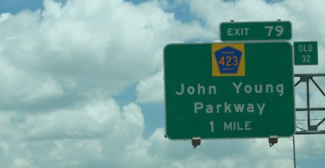
John Young Parkway is a major north-south surface arterial in metro Orlando, Florida, running roughly 20 miles from near Kissimmee in Osceola County to Winter Park. The state-maintained middle section is designated State Road 423 (about 7.5 miles); the southern stretch is County Road 423. The parkway runs parallel to and just east of Orange Blossom Trail (US 441) and serves as a free commuter alternative. It is named after John Young, a NASA astronaut who grew up in Orlando, commanded Apollo 16, and commanded the first Space Shuttle flight in 1981.

Here's something most people who move to Orlando figure out by accident: there's a road you'll drive a hundred times before you ever learn its name. It carries you to the mall, to your kid's school, to the highway on-ramp — and somewhere along the way you realize the green signs have said "John Young Parkway" the whole time.

It's not glamorous, and it's not a toll-road shortcut anyone brags about. But John Young Parkway is one of the most useful streets in Central Florida, and (bonus) it's named after a genuine American legend. Let's get into why this unassuming arterial deserves a spot on your mental map.

What John Young Parkway Actually Is

John Young Parkway is a four- to six-lane surface arterial — a regular signalized road, not an expressway — that runs roughly north-south through the western side of the urban core. End to end, the corridor covers about 20 miles, though it goes by a few different designations along the way.

The middle, state-maintained stretch is State Road 423, about 7.5 miles long. South of that, it's County Road 423, built out in pieces by Orange County and the state over the decades since the first section opened in the early 1970s. The practical takeaway: it's one continuous drivable parkway even if the road-nerd designations change underfoot.

Its whole reason for existing is to be a relief valve. John Young runs parallel to — and just a few blocks east of — the Orange Blossom Trail (US 441), the older, busier, more cluttered corridor. When OBT bogs down, locals slide over to John Young. That's the entire pitch, and it works.

Wait — It's Named After a Moonwalker?

Yes, and this is the fun part. John Young Parkway honors John Young, a NASA astronaut who grew up right here in Orlando and attended Orlando High School. Of all the names slapped on Central Florida roads, this might be the most quietly impressive.

Young's résumé is borderline absurd. He was the only person to fly in the Gemini, Apollo, and Space Shuttle programs, and the first human to launch into space six times. He commanded Apollo 16 in 1972, becoming the ninth of just twelve people to walk on the Moon. Nine years later, in 1981, he commanded STS-1, the very first Space Shuttle flight aboard Columbia.

He passed away in January 2018 at age 87. So the next time you're stuck at the light at Sand Lake Road, remember: this road is named for a hometown kid who saluted the flag on the surface of the Moon. (John Young Elementary carries his name too.) That's a pretty good "fun fact" to have in your back pocket.

Where It Goes: Kissimmee to Winter Park

Let's trace it honestly, south to north, because the route tells you a lot about who uses it.

The corridor's southern end is down near Pleasant Hill Road by Kissimmee, where it crosses the Osceola-Orange county line. From there it runs north as a commuter route through Hunter's Creek and other south Orange County suburbs, picking up interchanges with the toll roads as it goes: the 417 (Central Florida GreeneWay) and the 528 Beachline Expressway down south, then a single-point interchange at Sand Lake Road a short hop west of The Florida Mall.

Through the middle, John Young threads the Oak Ridge and Southpark commercial belt — big-box retail, office parks, and warehouses rather than postcard scenery. It crosses Interstate 4 via a flyover ramp near downtown, meets the 408 East-West Expressway, and continues to Orange Blossom Trail. There it bends east, becomes Lee Road, and finishes near Winter Park at US 17/92.

One honest caveat: John Young serves the central and southwest stretch of the metro. It does not reach the far-west communities like MetroWest or Horizon West, and it isn't your route to the beaches or the airport on its own — for that you'll lean on the expressways it intersects.

Why Orlando Drivers Actually Use It

Here's the thing: John Young Parkway is free. No SunPass, no E-PASS, no toll-by-plate bill three weeks later. In a metro practically gift-wrapped in toll roads — the 417, 528, and Florida's Turnpike all cross it — a fast, signal-controlled, no-cost north-south spine is valuable.

It's also wide and direct — six lanes for much of its length, with fewer driveways than OBT and grade-separated crossings at the interstates. For a south-Orange commuter heading toward downtown or the office districts, it's often the smart play.

The Pros

  • Completely free — no tolls anywhere on the parkway
  • A direct north-south alternative to congested Orange Blossom Trail
  • Connects to nearly every major expressway: I-4, 408, 417, 528, and the Turnpike
  • Six lanes through much of the route, with flyovers at I-4 and Sand Lake Road
  • Central access to Hunter's Creek, Oak Ridge, downtown-adjacent areas, and Winter Park

The Cons

  • It's a busy commercial arterial — traffic signals, retail traffic, and rush-hour backups are real
  • The Oak Ridge/Southpark middle stretch is industrial and commercial, not pretty
  • It won't get you west to MetroWest/Horizon West or directly to the beaches or MCO
  • Like any arterial, the at-grade intersections can be accident-prone at peak times

Living Near John Young Parkway: The Real Deal

Let's be real about what proximity to John Young means for a home search. Frontage on the parkway itself is mostly commercial, so you're not buying a house on John Young. What matters is the residential pockets a few minutes off it.

Down south, that's Hunter's Creek and the south Orange County neighborhoods near the Osceola County line — generally more affordable than the west-side suburbs, with quick access to three toll roads. Closer in, the parkway puts you minutes from Downtown Orlando employment centers without paying to get there.

Our take: if your daily life points toward downtown, the southwest job corridors, or the toll-road network, a home with easy John Young access is a quietly excellent piece of infrastructure to live near. If you crave quiet cul-de-sac scenery, stay a few blocks off it. It's a workhorse, not a showpiece — and there's nothing wrong with that.

What the Neighbors Know

John Young Parkway is the kind of road that never makes a "best of Orlando" list but ends up in your daily routine anyway. Locals treat it as the free, fast escape hatch from Orange Blossom Trail, the connective tissue stitching together south Orange County, the commercial core, and Winter Park — all without a single toll gantry.

And it carries a name worth knowing. Every time you drive it, you're rolling down a tribute to an Orlando kid who flew to the Moon and back, then strapped into the first Space Shuttle. For a region that runs on "anything is possible" energy, that feels exactly right. 🚀

For official route details, construction updates, and traffic information, visit the Florida Department of Transportation, which maintains State Road 423. You can also read NASA's tribute to the parkway's namesake at the John W. Young astronaut biography.


Trying to figure out which Orlando corridor fits your commute and budget? Explore our Geography of Orlando: Where to Live guide and our breakdown of Orlando's Four Counties Compared — or contact us for personalized relocation advice!

June 1, 2026

Semoran Boulevard (SR 436): Orlando's East-Side Workhorse

Semoran Boulevard (SR 436): Orlando's East-Side Workhorse

The 25.5-mile arterial that ties together Seminole County, east Orlando, and the airport — and why it should be on your radar even if you never drive it

Semoran Blvd  SR 436 in Orlando

Semoran Boulevard is the local name for State Road 436 (SR 436), a roughly 25.5-mile FDOT-maintained surface arterial in Central Florida. It runs from US 441 (Orange Blossom Trail) in Apopka through Forest City, Altamonte Springs, Casselberry, and east Orlando before terminating at Orlando International Airport (MCO). It is a free road, not a toll road, crossing both Orange and Seminole counties. The name "Semoran" is a portmanteau of Seminole and Orange counties, chosen through a 1967 newspaper contest.

Let's be real about something up front: if you're shopping for a home on the west side of metro Orlando — Dr. Phillips, Windermere, Winter Garden — you will probably never drive Semoran Boulevard in your daily life. SR 436 lives on the other side of town. So why write about it at all?

Because where a road goes tells you how a metro is shaped. Semoran is the spine of Orlando's north-and-east corridor, and if you're weighing the Seminole County suburbs against the west side — or you just want the cheapest reliable way to reach the airport from up north — this is a road worth understanding before you sign anything.

What Semoran Boulevard Actually Is

Semoran Boulevard is the everyday name for State Road 436, a roughly 25.5-mile surface arterial maintained by the Florida Department of Transportation. Here's the part people get wrong: it's a free road. No SunPass, no E-PASS, no tolls anywhere along it. That alone makes it strategically different from the expressways it crosses.

The road arcs east and then south from US 441 (Orange Blossom Trail) in Apopka all the way down to Orlando International Airport (MCO), where it ends at a flyover into the terminal complex. Along the way it threads through Forest City, Altamonte Springs, Casselberry, and the east-Orlando neighborhoods around Azalea Park. For most of its length it's a six-lane commercial corridor — the kind of road lined with strip plazas, car dealerships, and big-box stores rather than scenic anything.

It also crosses nearly every major expressway in the metro: Interstate 4 in Altamonte Springs, the 408 East-West Expressway in east Orlando, and finally the 528 Beachline at the airport. That web of connections is the whole point of Semoran.

Where the Name Comes From

Fun fact for your next Orlando trivia night: "Semoran" isn't a Native American word or a developer's invented brand. It's a portmanteau — a smashing-together of Seminole and Orange, the two counties the road runs through. The winning name came out of a 1967 newspaper contest, and locals have been mangling the pronunciation ever since (most people say "seh-muh-ran," not "Seminole-Orange").

The road itself is older than the name. SR 436 has existed in some form since the 1940s, originally conceived as a partial bypass stitching together existing roads to route traffic around Orlando. The east-west stretch from Apopka to Altamonte Springs is significantly older than the southern leg down to the airport, which is why the road changes character so dramatically depending on where you are on it.

The Communities Along 436 — And Who They're For

Here's where we keep it honest. Semoran is the connective tissue of communities FNR's west-side buyers usually aren't looking at — and that's not a knock, it's just geography. The corridor serves Apopka, Altamonte Springs, Casselberry, the eastern edge of Winter Park, and a string of established east-Orlando neighborhoods.

If you're relocating and trying to decide between the east side and the west side, this matters a lot. Much of Semoran sits in Seminole County, which means a different school district, different commute patterns, and a generally older, more built-out feel than the master-planned communities out west. Want to compare the homework on that? Our guides to Seminole County Public Schools and Orlando's four counties are the place to start, and the geography of Orlando breaks down the east-versus-west question in plain terms.

The corridor isn't all asphalt and strip malls, either. Cranes Roost Park and Lake Lotus Park in Altamonte Springs, Red Bug Lake Park in Casselberry, and the shopping at Altamonte Mall are all right off 436. Slide a little east and you're into Park Avenue and Winter Park's dining scene.

Your Free Road to the Airport

Here's the single most useful thing to know about Semoran no matter where you live: it dead-ends at MCO. The southern terminus feeds straight into a flyover to Jeff Fuqua Boulevard and the terminals.

That makes SR 436 the budget alternative to the tolled 417 GreeneWay if you're heading to the airport from the north or northeast. The trade-off is honest and obvious: 436 is a signalized surface street with traffic lights and rush-hour congestion, so it's slower than the expressway. For an early-morning flight with no traffic, it can save you a few bucks in tolls. At 5 p.m. on a Friday, pay the toll and take the 417.

The Real Deal: Living Near Semoran

If a home you love happens to sit near SR 436, weigh it clear-eyed. This is a working arterial, not a quiet parkway.

The Pros:

  • Everything is close — groceries, pharmacies, restaurants, and big-box retail are usually minutes away
  • Free, direct access to MCO and easy hops onto I-4, the 408, and US 17-92
  • Generally more affordable, established housing than west-side master-planned communities
  • Strong Seminole County school options on the northern stretch

The Cons:

  • Traffic and noise — six lanes of commercial arterial means congestion and constant activity
  • Commercial sprawl: the corridor itself is functional, not charming
  • Lots of signalized intersections make for stop-and-go driving

Our Take:

Buy near Semoran for convenience and value, but aim for a home a few streets off the boulevard rather than fronting it. You get the access without living inside the traffic. If you'd rather have the master-planned, quieter west-side lifestyle, that's a different corner of the metro entirely — and a different conversation.

What the Neighbors Know

Semoran Boulevard won't win any beauty contests, and most FNR clients out west will only ever meet it on the way to a flight. But it's one of the most useful roads in Central Florida: a free, 25.5-mile connector that ties the north-and-east suburbs to every expressway in town and drops you right at the airport.

If your search is pulling you toward Seminole County or east Orlando, understanding 436 — its convenience, its congestion, and its honest trade-offs — will help you pick the right street, not just the right ZIP code. And that's the whole game. 🚗

For official route maps, construction updates, and current project information, visit the Florida Department of Transportation. For airport access details at the southern terminus, see the Greater Orlando Aviation Authority, and for Seminole County corridor projects, check Seminole County.


Trying to figure out whether the east side or west side of Orlando fits your life? Read The Geography of Orlando: Where to Live or contact us for honest, no-pressure relocation advice!

June 1, 2026

Orange Blossom Trail: Central Florida's Original Main Road

Orange Blossom Trail: Central Florida's Original Main Road

The story behind US 441 — the 400-mile highway that helped build Orlando long before I-4 ever existed

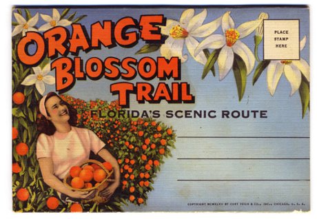
Orange Blossom Trail in Orlando old postcard

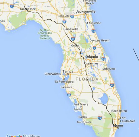
The Orange Blossom Trail (OBT) is the local name for U.S. Route 441 as it passes through Central Florida. For about 30 miles between Kissimmee and Apopka it runs concurrent with US 17 and US 92 and travels directly through Orlando. US 441 is a 400-plus-mile federal highway running from Miami to the Georgia state line, and through the 1950s and 1960s OBT was Central Florida's premier north-south route for tourists. Today the corridor ranges from busy suburban retail near the Florida Mall to a roughly seven-mile Orlando urban stretch, between Colonial Drive and Sand Lake Road, that has been the focus of redevelopment since the Orange Blossom Trail Development Board formed in 1985.

Here's a road you've almost certainly driven, probably without giving it a second thought: Orange Blossom Trail. Locals just call it "OBT," and depending on which stretch you're on, it can feel like a different highway entirely. So before the reputation gets a word in, let's set the record straight — because there's a lot more to this one than most people realize.

OBT isn't some minor surface street. It's U.S. Route 441, a federal highway that runs more than 400 miles from Miami up to the Georgia line. And in Central Florida, it was here first — this was the main road into Orlando back when "the attractions" meant citrus stands and roadside motels, not theme parks.

So What Exactly Is the Orange Blossom Trail?

Officially, OBT is the Central Florida designation for US 441. For roughly 30 miles between Kissimmee and Apopka, the highway runs together with US 17-92, which is why you'll sometimes see a confusing stack of route shields on the same pole. The name itself is a nod to Florida's citrus heritage — back when this corridor cut straight through orange groves in bloom.

If you're house-hunting and a listing mentions OBT, US 441, or "the Trail," they're all the same road. What changes — dramatically — is the neighborhood around it.

Florida's Original Tourist Highway

Here's the fun fact for your next dinner party: in the 1950s and '60s, Orange Blossom Trail was Orlando tourism. It was the area's premier north-south route, lined with hotels, restaurants, and the kind of neon roadside businesses that defined mid-century Florida travel. If you were driving down to see the springs, the citrus towers, or early Central Florida attractions, you did it on OBT.

Then everything changed. When Interstate 4 opened and Walt Disney World arrived in 1971, the tourist traffic shifted to the interstate practically overnight. The grand old motels on OBT lost their reason for being, and over the following decades parts of the corridor slid into disinvestment. That's the short version of how a once-glamorous highway picked up a reputation it's still working to shed.

Following 441 Beyond the Metro

Most people only ever experience the Orlando slice of OBT, but the highway keeps going in both directions — and that's where it gets interesting for anyone exploring where to put down roots.

Heading south, US 441 pairs up with US 192 (Irlo Bronson Memorial Highway) for about 15 miles through Osceola County before splitting off and turning north in downtown Kissimmee. This is the tourist-corridor end of things, with easy reach to the parks and a deep bench of dining and retail — you can browse our complete Kissimmee restaurants and dining guide for a sense of what's down there.

Heading north, 441 leaves Orlando, crosses the toll-road tangle of SR 429 near Apopka, then rolls into Lake County. From here it becomes genuinely scenic, threading through the chain-of-lakes towns of Mount Dora, Eustis, and Tavares — historic downtowns and waterfront views that feel a world away from the urban core — before joining US Highway 27 at Leesburg. Same highway number, completely different vibe.

Let's Be Real About the Urban Stretch

We're not going to pretend the reputation came from nowhere. The part of OBT that earned it is a roughly seven-mile urban stretch in Orlando, between Colonial Drive (SR 50) and Sand Lake Road, where you'll find aging motels, pawn shops, and pockets of crime that have been a documented concern for decades. It's the kind of corridor where many longtime locals will tell you to use the 408 Expressway or John Young Parkway as alternatives, especially after dark.

That said, it's still a working artery that runs right through the heart of the city and connects to Downtown Orlando. Tens of thousands of ordinary commuters, workers, and shoppers use it every single day. The honest read isn't "avoid OBT" — it's "know which segment you're in," because the character genuinely changes block by block.

The Comeback Story

What a lot of people don't know is that there's an organized, decades-long effort to turn the urban corridor around. The Orange Blossom Trail Development Board has been working on exactly this since 1985, in partnership with the City of Orlando, Orange County, and the Florida Department of Transportation.

Their "OBT Next" master plan lays out a long-term strategy for an eight-mile section of the Trail — everything from infrastructure and streetscape improvements to park reconstruction and new housing. It's slow, generational work, but it means the corridor's future isn't being left to chance. For relocating buyers, that's a meaningful signal: the cheap-today blocks may not stay overlooked forever.

What This Means If You're House-Hunting Near OBT

So should a home near Orange Blossom Trail be on your list? Here's our honest take.

The Pros:

  • Central location — OBT links Kissimmee, south Orlando, downtown, and Apopka along one straight north-south line
  • Commercial convenience, with major retail like The Florida Mall (300-plus stores, 20+ million visitors a year) sitting right on the corridor
  • Generally more affordable housing than you'll find on the west side or near the parks
  • Active, funded redevelopment in the urban core

The Cons:

  • The Colonial-to-Sand Lake stretch still carries real safety and blight concerns
  • Heavy commercial traffic and a stop-light-heavy drive on the busiest sections
  • Quality varies sharply from one block to the next, so two homes on "OBT" can be nothing alike

Our Take:

If you're drawn to the affordability and central access, focus on the suburban ends — the Kissimmee side or the Lake County towns up north — and tour any prospective block in person, day and night. If you want quiet and predictability, you'll likely be happier a bit off the corridor. Either way, judge the specific neighborhood, not the highway's name. A little homework along the Trail goes a long way — and our Kissimmee shopping guide is a good place to see how lively the southern end has become.

What the Neighbors Know

Ask anyone who's lived here a while and they'll tell you the same thing: Orange Blossom Trail isn't one place, it's a dozen. It's the citrus-era highway that put Orlando on the map, the tourist drag near the parks, the busy retail run past the Florida Mall, the gritty-but-improving urban core, and the postcard-pretty route through the Lake County lakes. The reputation is real for one slice of it — and unfair to all the rest.

For a relocating family, the takeaway is simple. OBT is a fantastic shorthand for "centrally located and affordable," but it demands a closer look than almost any other road in the metro. Drive the exact stretch you're considering, check it at different hours, and you'll quickly see why the locals never lump it all together. Do that, and the Trail can hold some genuinely smart buys. 🍊

For corridor plans, redevelopment projects, and current initiatives, visit the official Orange Blossom Trail Development Board website.


Trying to figure out which Central Florida corridor fits your move? Explore our Kissimmee and Downtown Orlando guides, or Contact Us for personalized relocation advice along OBT and beyond!

June 1, 2026

US 17-92: Central Florida's Original Main Street

US 17-92: Central Florida's Original Main Street

Before I-4 took over, this was the road that tied Orlando together — and it's quietly reinventing itself

US Hwy 17-92 sign

US 17-92 is a surface highway through Central Florida formed where U.S. Route 17 and U.S. Route 92 run concurrently. It serves as a major north-south corridor connecting Sanford, the Seminole County suburbs, Winter Park, Orlando, and the southern metro toward Kissimmee, running roughly parallel to Interstate 4. US 92 alone is about 181 miles long, running entirely within Florida from St. Petersburg to Daytona Beach. The 17-92 corridor was Central Florida's main highway before I-4 opened, and large stretches of it are now the focus of long-running redevelopment efforts in Seminole County, Winter Park, and Maitland.

So you've memorized I-4 and you've got the 408 and 417 down. But spend a week driving around Orlando and you'll keep hitting a road that everyone just calls "17-92." It cuts through half the metro, it's lined with everything from vintage motels to brand-new apartments, and odds are you'll end up on it whether you planned to or not.

Here's the thing: 17-92 isn't glamorous. It's not a toll road that whisks you anywhere fast. But understanding it tells you a lot about how Central Florida actually grew up — and if you're house-hunting anywhere east of the theme-park bubble, it's worth knowing what living near it really means.

Let's take the tour.

So What Is 17-92, Exactly?

Quick geography lesson (we promise it's painless). 17-92 isn't one highway — it's two. U.S. Route 17 and U.S. Route 92 happen to share the same pavement through much of Central Florida, a setup road nerds call a "concurrency." Rather than make you pick a favorite, the signs just stack both numbers together: 17-92.

US 92 on its own is about 181 miles long and lives entirely in Florida, running from St. Petersburg all the way to Daytona Beach. US 17 piggybacks on it for roughly half that distance. The combined route runs largely parallel to Interstate 4 — which is exactly why most through-traffic now takes I-4 and leaves 17-92 to the locals.

From Main Drag to "Remember When": A Quick History

Before I-4 sliced through the region in the 1960s, 17-92 was the way you traveled Central Florida. It was the original main thoroughfare connecting the area's towns, the road your grandparents would've driven from Sanford to Orlando back when Orlando was still a citrus-and-cattle town.

When I-4 opened, it siphoned off the fast traffic almost overnight. 17-92 settled into a second act as a local commercial spine — the place for car dealerships, diners, strip plazas, and the occasional gloriously retro neon sign. That faded-glory vibe is still there in stretches, and it's a big reason so many cities along the corridor have spent decades trying to spruce it back up (more on that below).

The 17-92 Road Trip: Kissimmee to Sanford

Picture driving the corridor south to north. Here's roughly what you'd pass:

  • The south end (Osceola County): Down near Kissimmee, 17-92 tangles up with Orange Blossom Trail (US 441) and Highway 192, forming the busy commercial backbone of the southern metro. This stretch also runs near the eastern edge of the Hunter's Creek area, close to where the SR 417 Eastern Beltway begins its loop around town.
  • Through Orlando: 17-92 threads up through south Orlando and into the urban core near Downtown Orlando, where it crosses paths with just about every major road in the metro.
  • Winter Park & Maitland: The corridor slips past Park Avenue's shops just to the east, an interesting contrast of polished and workaday side by side.
  • Seminole County: This is where 17-92 gets seriously busy — Fern Park, Casselberry, Longwood, Altamonte Springs, Lake Mary, and Sanford. You'll roll past Altamonte Mall and the fountains of Cranes Roost Park along the way.
  • The north end: Up in Sanford, 17-92 runs near Orlando Sanford International Airport before continuing toward DeBary and DeLand in Volusia County.

One genuinely handy thing: SunRail, our commuter train, shadows the 17-92 corridor for almost its entire length. So if traffic on 17-92 isn't your thing, there's often a train station within a few minutes of it.

The Great 17-92 Makeover

Here's where it gets interesting. For decades, the cities along 17-92 have been working to transform that tired commercial strip into something more walkable and attractive. Seminole County and its cities created a multi-jurisdictional redevelopment effort for the corridor years ago, and Winter Park, Maitland, and Casselberry have run their own redevelopment programs along their slices of 17-92. Winter Park even expanded its redevelopment area along the corridor as recently as 2024.

The road itself has gotten real attention, too. Back in 2015, a roughly $80 million flyover opened where 17-92 meets Highway 436 (Semoran Boulevard) in Casselberry — long considered one of the busiest intersections in the entire state. And in early 2025, FDOT wrapped up a project rebuilding the I-4 and 17-92 interchange near downtown Sanford, adding turn lanes, smoother ramps, and pedestrian safety upgrades.

The honest takeaway: 17-92 is a work in progress. Some stretches feel freshly reinvented; others are still waiting their turn.

Should You Live Along the 17-92 Corridor?

Let's be real about the trade-offs, because plenty of great neighborhoods sit just off this road.

The Pros:

  • Central location — you're rarely far from downtown, the airports, or I-4
  • Generally more affordable home prices than the newer master-planned suburbs out west
  • SunRail commuter stations sprinkled all along the corridor
  • Mature, tree-lined established neighborhoods (especially around Winter Park and Maitland)
  • Walkable redevelopment districts popping up in Casselberry, Maitland, and beyond

The Cons:

  • Traffic and signal-heavy driving — this is a surface road, not an expressway
  • Some commercial stretches still look dated or in transition
  • Noise and congestion right along the road itself (look a block or two off it)

Our Take:

If you value being central and want more house for your money, the neighborhoods tucked just off 17-92 are worth a serious look — just shop a street or two back from the highway. Much of the corridor's heart runs through Seminole County and the Winter Park area, so it's a great fit for buyers eyeing the established eastern and northern metro rather than the brand-new western suburbs. You can browse listings across Orange County and Osceola County to get a feel for what's out there.

What the Neighbors Know

17-92 will never be the prettiest road in town, and it'll never be the fastest. But it's woven into the fabric of Central Florida in a way the shiny toll roads just aren't. It's where the region started, it's where a surprising amount of daily life still happens, and it's slowly becoming something nicer one redevelopment project at a time.

The local move? Use it like a resident: know which intersections to avoid at 5 p.m., keep SunRail in your back pocket, and remember that some of the best-value neighborhoods in the metro are hiding just off this unassuming old highway. Not bad for a road most newcomers drive right past. 🚗

For current project information, lane closures, and corridor improvements, visit the Florida Department of Transportation's official US 17-92 project page.


Trying to figure out which Central Florida neighborhood fits your commute, budget, and lifestyle? Explore our community guides for Kissimmee and Hunter's Creek, or Contact Us for personalized relocation advice. We'll help you find the right spot — on 17-92 or anywhere else in the metro!

May 31, 2026

Lake Technical College: Central Florida's Career Launchpad

Lake Technical College: Central Florida's Career Launchpad

How a Lake County trade college quietly turns out nurses, firefighters, and welders — often in a year or less

Lake Technical College

Lake Technical College (Lake Tech) is a public career and technical college located at 2001 Kurt Street in Eustis, FL, operated by the Lake County Schools district. It offers more than 30 certificate programs across nine fields of study, including healthcare, public safety, and skilled trades, and most can be completed in one year or less. The main campus is about 33 to 37 miles northwest of downtown Orlando, roughly a 50-minute drive via US-441 or the SR 429 toll road. Lake Tech has been accredited by the Council on Occupational Education since 1974 and operates additional locations in Tavares and Clermont.

When families relocating to Central Florida think about education, the conversation usually jumps straight to UCF, four-year degrees, and student-loan math that makes everyone wince. But here's something a lot of newcomers miss: some of the fastest paths to a solid, well-paying career around here don't run through a university at all. They run through a technical college — and one of the best is sitting up in Lake County.

Meet Lake Technical College, or "Lake Tech" as locals call it. Its motto is basically "career in a year," and it's been quietly turning out nurses, firefighters, welders, and cosmetologists for the north-metro region since the 1960s. Whether you're a parent eyeing options for a teenager who'd rather build engines than write essays, or an adult ready to switch careers without four years of tuition, this is a place worth knowing about.

Let's be real, though: Lake Tech isn't around the corner if you live in the urban core — so we'll give you the honest geography too.

What Exactly Is Lake Tech?

Lake Technical College is a public career and technical college — it trains students for specific jobs and industry certifications rather than awarding traditional bachelor's degrees. It's run by the Lake County Schools district and serves both teenagers and adults under one roof.

The numbers tell the story: Lake Tech offers more than 30 certificate programs spread across nine fields of study, and the majority can be finished in a year or less. It's accredited by the Council on Occupational Education (COE), the national body that vets career and technical schools, and its individual programs carry their own industry approvals from groups like the Florida State Board of Nursing and the Florida Fire Academy.

A Quick History: From a 1960s Vocational Center to Today

Here's a fun fact for trivia night: Lake Tech's roots go back more than half a century. The Lake County School Board sought state approval for a vocational center in 1963, and once federal funding came through, the first programs — cosmetology, auto mechanics, and business education — launched in 1966 in Leesburg while the permanent building went up.

The main campus opened in Eustis in 1968, and the school earned its initial COE accreditation in 1974 — a streak it has maintained ever since. Originally known as Lake Technical Center, it was rebranded Lake Technical College to reflect its postsecondary role.

The Programs: What You Can Actually Study

This is where Lake Tech earns its keep. The lineup leans heavily toward careers Central Florida is hungry to fill — healthcare and public safety in particular. A sampling of what's on offer:

  • Healthcare: Practical Nursing (LPN), Emergency Medical Technician (EMT), Paramedic, Nursing Assistant (CNA), Patient Care Technician, Phlebotomy, and Massage Therapy
  • Public Safety: Law Enforcement Basic Recruit, Correctional Officer, and Firefighter — run through Lake Tech's Institute of Public Safety
  • Skilled Trades: Applied Welding Technologies, Automotive Service Technology, Auto Collision Repair, HVAC, and CNC Machining
  • Personal & Hospitality Services: Cosmetology, Facial and Nail specialties, and Commercial Foods & Culinary Arts
  • Business & Education: Accounting Operations, Administrative Assistant, and Early Childhood Education
  • Adult Education: GED preparation, ESOL, and Adult Basic Education classes

The healthcare programs are the headliners — EMT, paramedic, and practical nursing rank among the most popular, which tracks given how fast Central Florida's hospital systems keep expanding. For the bigger picture, our guide comparing Central Florida's four school districts is a good companion read.

Why Should Orlando-Area Families Care?

For Teenagers (and Their Parents)

Not every kid is wired for a four-year degree, and that's fine. Through dual-enrollment agreements with Lake and Sumter County Schools, eligible high schoolers can earn marketable certifications before they graduate — a head start most families would take in a heartbeat. For the broader K-12 picture, see our Lake County Schools Guide.

For Career Changers and Adults

Maybe you're relocating and need a faster, cheaper route into a stable field than a university offers. Lake Tech charges tuition by the clock hour, keeping total costs well below a four-year degree, and it's federal-aid eligible (file the FAFSA). For someone who wants to become a licensed nurse, firefighter, or welder without a mountain of debt, the math is hard to argue with.

The Honest Geography

Now the part we promised to be straight about: location. Lake Tech's main campus sits at 2001 Kurt Street in Eustis, roughly 33 to 37 miles northwest of downtown Orlando. Figure about a 50-minute drive via US-441 or the SR 429 toll road. That's perfectly reasonable if you live in northern Lake County, but it's a real commute from Lake County's southern edge or from Orlando proper. This is a Lake County asset first and a metro-Orlando asset second — and we'd rather tell you that than oversell it.

The Campuses

Lake Tech isn't a single building. It spreads across several locations in the region:

  • Main Campus — 2001 Kurt Street, Eustis (the bulk of the academic and trade programs)
  • Institute of Public Safety — in Tavares, home to firing and driving ranges plus classrooms for law enforcement, corrections, and firefighter training
  • Clermont location — shared with the Lake-Sumter State College campus in Clermont, serving south Lake County

That Clermont tie-in matters: Lake Tech and Lake-Sumter State College work hand in hand, so a certificate can sometimes flow into an associate degree next door. Weighing a certificate against a degree? It's worth glancing at sister schools in neighboring counties like Orange Technical College and Valencia College.

The Real Deal: Pros and Cons of the Lake Tech Path

The Pros:

  • Fast — most programs finish in a year or less, so you're earning sooner
  • Affordable compared with a four-year degree, and FAFSA-eligible
  • Hands-on training aimed squarely at in-demand local jobs
  • Dual enrollment lets high schoolers get a head start
  • Long-standing, continuously accredited (since 1974) with strong industry ties

The Cons:

  • It's a commute if you live in central or south metro Orlando
  • Certificates aren't the same as a four-year degree — some careers still require one
  • Popular health programs can have competitive entry and limited seats

Our Take:

If you're settling in the north-metro area — Mount Dora, Eustis, or Tavares — Lake Tech is a genuine quality-of-life perk and a low-debt career on-ramp. If you're in the urban core and don't mind the drive, it's still a fine option for specialized training. Curious what the surrounding towns feel like? Our take on Downtown Mount Dora is a charming starting point.

What the Neighbors Know

Lake Technical College won't show up in the relocation brochures next to the theme parks, but locals know it's one of Lake County's most practical assets. It's the kind of place that turns a year of focused effort into a licensed, paycheck-earning career — no four-year detour required.

For a fast-growing region that constantly needs nurses, first responders, and tradespeople, a school like this in the backyard is a quiet advantage. For families weighing where to plant roots in Central Florida, it's one more reason the north-metro Lake County towns deserve a serious look. 🎓

For current programs, enrollment dates, and tuition details, visit the official Lake Technical College website, check the school's accreditor at the Council on Occupational Education, or learn more about the parent district at Lake County Schools.


Thinking about a move to Lake County or anywhere in Central Florida? Browse our Lake County homes for sale or reach out to our team for personalized relocation advice!